
Features in the landscape, such as urban development, agriculture, wetlands, and forests, can affect the water quality of a watershed. However, determining the role and the extent of each of these land uses is challenging, especially when the watershed is multi-use, as is the case for many watersheds.
Agricultural Research Service (ARS) scientists in the Hydrology and Remote Sensing Laboratory (HRSL) and the Sustainable Agricultural Systems Laboratory (SASL) have developed several new techniques to examine the contributions of nutrients from agricultural lands. This information will be used to examine the effectiveness of conservation practices and to make better predictions about how land-use changes will influence water quality in the Lower Chesapeake Bay.
This work is part of the Long-Term Agroecosystem Research Network, which was created by ARS to study environmentally important watersheds, such as the Lower Chesapeake Bay.
Photos by Peggy Greb.
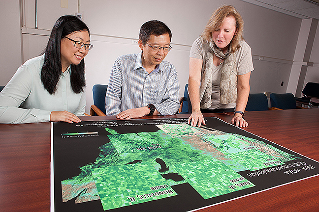
HRSL scientists Martha Anderson, Feng Gao and Yun Yang view high resolution maps of evapotranspiration (ET), or crop water use, over various agricultural landscapes in the U.S. These maps were generated with a multi-sensor data fusion approach, leveraging information about land-surface temperature and evaporative cooling that can be obtained with spaceborne thermal infrared imaging. These ET datasets can be used to manage irrigation, estimate drought impacts on yield, and map crop water productivity.
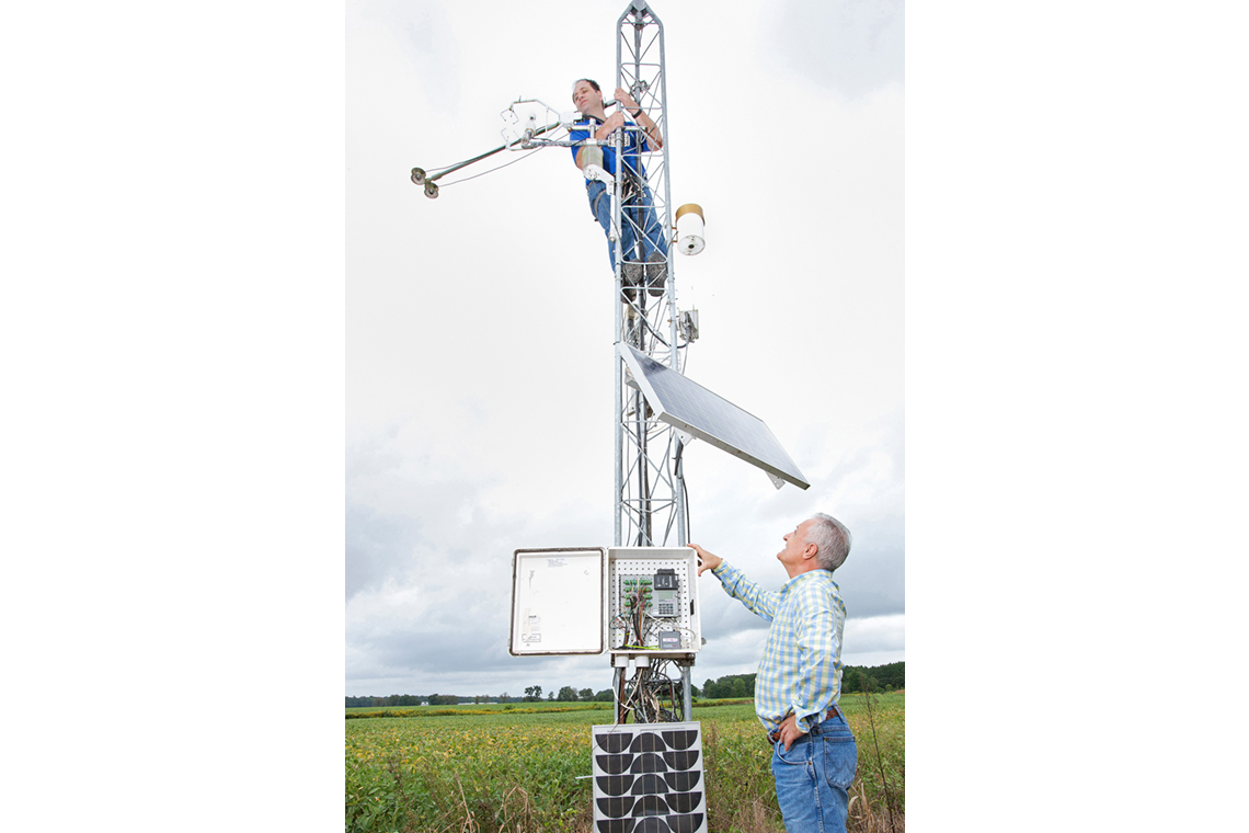
HRSL physical scientist Joseph Alfieri adjusts the wind sensor on a meteorological tower located in the Choptank watershed while HRSL soil scientist Ali Sadeghi monitors the data logger on the ground. The data collected by the tower is critical to understanding the transport and fate of water, particulates, and agrochemicals within the larger Chesapeake Bay watershed. The data is also used to evaluate and improve water quality and remote sensing-based models.
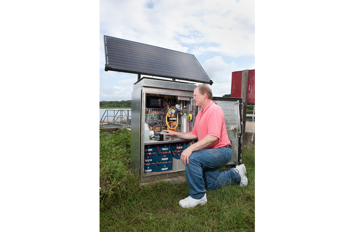
Greg McCarty, a soil scientist with HRSL, calibrates sensors that measure nitrate, organic carbon, and turbidity of stream waters in real time. Several of these newly developed sensor systems have been deployed in the Chesapeake Bay watershed near U.S. Geological Survey stream gauges. The data obtained from these sensors is being used to examine effects of drought and precipitation on the total amount of nutrients and sediment delivered to the bay.
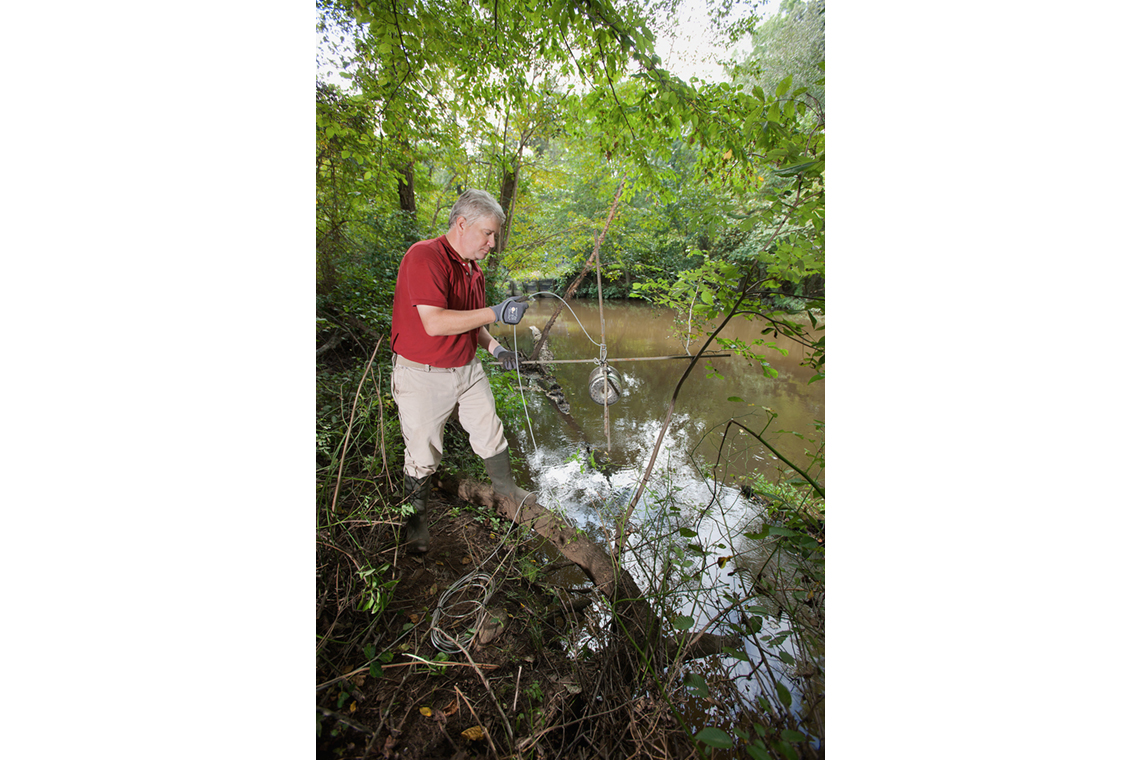
Peter Downey, an agronomist with HRSL, prepares to deploy a series of POCIS (polar organic chemical integrative samplers) in a tributary of the Chesapeake Bay. These samplers capture organic compounds in the water which can be used as tracers for nitrate from agricultural and urban sources. These samplers will remain submerged in the waterway for 28 days and then will be retrieved and analyzed.

After the POCIS are collected from the field sites, the discs inside are removed in the lab and processed. Rebecca Plummer, a chemist with HRSL, processes the matrix inside the discs to prepare it for analysis on a liquid chromatograph tandem quadrupole mass spectrometer (LC-MS/MS). This new method is faster and requires laboratory processing which allows for more samples to be processed.
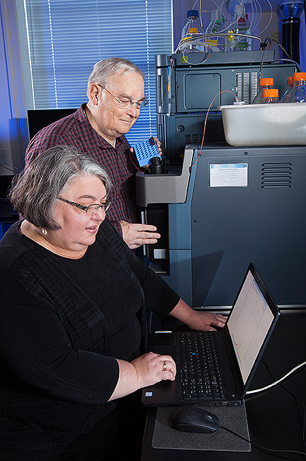
Research chemists Cathleen Hapeman (HRSL) and Clifford Rice (SASL) use a liquid chromatograph tandem quadrupole mass spectrometer (LC-MS/MS) to study water samples from the POCIS. The data obtained will be coupled with landscape and other stream data to consider the source of nutrients in the streams.
Print this page